Home › Places › Nature & trails › Strada delle 52 Gallerie
Adventure hiking in Vicenza
Walk the pasubio road, featured among "The world’s most dangerous roads”
52 tunnels, sheer limestone cliffs and a spiral ascent inside a rock tower in the mountains of northern Italy.
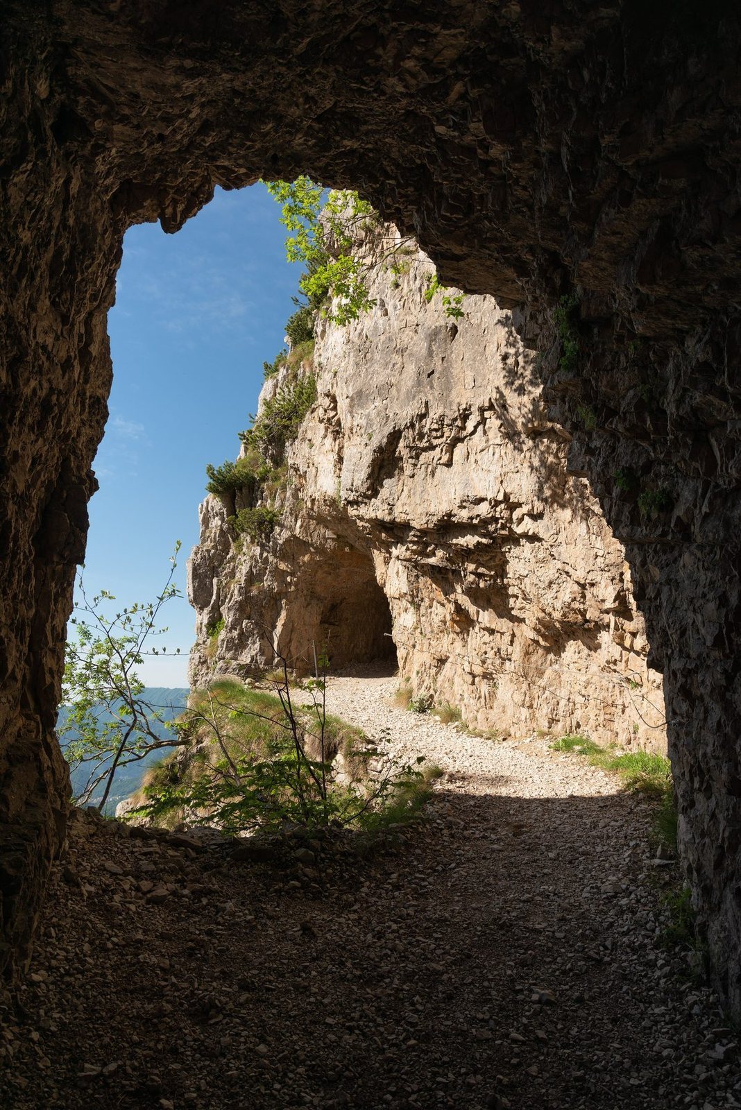
Adventure Bike Rider featured Pasubio Road in its “The world’s most dangerous roads” series. North of Vicenza, the Strada delle 52 Gallerie crosses sheer limestone faces through a succession of tunnels and exposed ledges, including a passage that spirals upwards inside a rock tower. Experienced hikers can follow the ascent to Rifugio Achille Papa, a mountain refuge serving lunch and accommodating overnight guests during its opening season.
You have saved two places. Leave your email and you will find them on any device, plus the next drop.
Giorgio Galeotti · CC BY 4.0 · Wikimedia Commons
Know before you go
This is an exposed mountain hike with unlit tunnels. Check trail notices, snow conditions and the mountain weather forecast before departure. The refuge’s opening calendar does not guarantee that the tunnel route is passable.
About
THE STORY
Adventure Bike Rider included the Pasubio Road in its series on “The world’s most dangerous roads”. Smithsonian photographed it while retracing what it described as the most treacherous mountain battle of the First World War. Today the road is crossed only on foot, bicycles are prohibited after fatal accidents.
About an hour north of Vicenza, Monte Pasubio rises on the old wartime border between Italy and the Austro Hungarian Empire. The hike begins at Bocchetta Campiglia, a mountain saddle at 1,216 metres, and climbs to the high Pasubio ridge and Rifugio Achille Papa at around 1,930 metres.
The extraordinary part is the road itself. In 1917, around 600 men spent roughly ten months cutting a military supply route directly through the mountain, hidden from Austrian artillery. Official Pasubio sources describe it as one of the greatest military works of the entire First World War, probably without equal elsewhere.
Over just 6.3 km, the mountain swallows the road 52 times. Around 2.3 km are underground, while the exposed sections have been carved into cliffs, pinnacles and deep ravines. The original road had to be wide enough for loaded mules, despite gradients reaching 22 percent.
And some of the tunnels are wonderfully improbable. Tunnel 19 is around 320 metres long and climbs through four internal bends. Tunnel 20 spirals four times inside a single tower of rock, like a stone corkscrew. Four tunnels are helical. Others contain openings cut through the cliff, so after minutes of darkness you suddenly get a frame of sky and the valleys hundreds of metres below.
Each tunnel has a number and a name, still marked at its entrance. The road gradually becomes a sequence of complete darkness, wet stone, echoing footsteps, exposed ledges and sudden views across the Vicentine Prealps.
WHY GO
For one of those rare hikes where the historical object is the trail beneath your feet. You are walking the original 1917 military road, through 52 tunnels excavated while the battle for Pasubio was still taking place above.
THE HIKE
Start: Bocchetta Campiglia, 1,216 m Finish: Rifugio Achille Papa, around 1,930 m Road: about 6.3 km one way Underground: about 2.3 km Tunnels: 52 Ascent: around 750 m Uphill: approximately 2 hours 45 minutes to 3 hours 30 minutes
The usual descent follows the Strada degli Scarubbi, another First World War military road on the opposite side of the mountain, creating a longer loop back to Bocchetta Campiglia.
GOOD TO KNOW A headlamp is essential. Several tunnels are completely dark and the floor can be wet and uneven. This is a mountain hike with exposed sections and rapidly changing weather, not an urban walking trail. Snow can remain around tunnel entrances well beyond winter. Bicycles are prohibited.
DIRECTIONS
From Vicenza, drive north through Schio, then continue towards Valli del Pasubio, a mountain village below the Pasubio massif.
Follow the road towards Passo Xomo, a mountain pass at 1,058 metres. From Passo Xomo, continue approximately 1.6 km uphill to Bocchetta Campiglia, where the paid parking area and the entrance to the Strada delle 52 Gallerie are located.
Once parked, look for CAI trail 366. The 52 Tunnels road begins directly from Bocchetta Campiglia and climbs towards Rifugio Achille Papa.
CURRENT ACCESS
Before leaving Vicenza, check mountain weather, snow conditions and current trail information. Guided hikes are also organised on the rout
In the mountains above Vicenza the same word described a narrow passage across stone, and a tiny plot of ground held by dry stone walls.
The Vicenza Lexicon →