Home › Places › Nature & trails › Rocchette Arsiero rail trail
EASY CYCLING IN VICENZA · FORMER RAILWAY TRAIL
Ride the “vaca mora”, the black cow railway trail, through five tunnels above the astico
Cycle an old railway through five tunnels above a mountain river in northern Italy
About eight kilometres on the old railway line, with gentle gradients, historic bridges, illuminated tunnels and views across the Vicenza Prealps. The railway opened in 1885 and closed in 1964. Today its former trackbed gives cyclists and walkers an easy route through the Astico Valley, passing five tunnels and old railway bridges. The steam engines were known locally as the Vaca Mora, the Black Cow.
You have saved two places. Leave your email and you will find them on any device, plus the next drop.
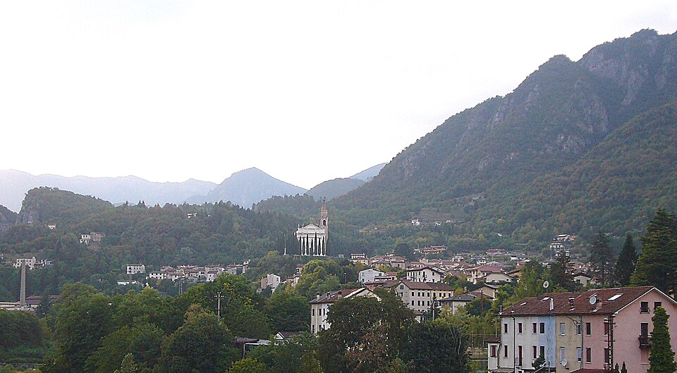
Marchetto da Trieste, CC BY-SA 4.0 via Wikimedia Commons
Know before you go
This is a dedicated cycling and walking route on the former railway line. Its railway gradients make it suitable for an easy ride or walk, including families. INFO iat.tonezza@provincia.vicenza.it; +39 0445 749500
About
THE STORY
Around 30 km north of Vicenza, the plain closes into the Astico Valley, named after the Astico, the mountain river running below the route. Here an old railway line survives as an easy cycle and walking trail through five tunnels, two railway bridges, cultivated countryside and the first walls of the Vicentine Prealps. FIAB records the whole 8 km former railway section as recovered for cyclists and pedestrians.
THE BLACK COW
The local word is the best part. Vaca Mora means “Black Cow” in Veneto dialect, an old nickname for Vicenza’s steam trains. One story says railwaymen made the smoke leave the chimney in two black plumes, giving the locomotive the appearance of a cow with horns. Other sources connect the name more simply with the dark, slow steam engines themselves.
From the saddle, the railway still behaves like a railway. The gradient stays gentle, the route cuts into rock, disappears into five old tunnels, crosses former railway bridges and opens repeatedly towards Monte Cimone, Cengio, Paù and the Novegno Summano mountain group. The tunnels are illuminated, but the sudden drop in temperature and sound inside the stone is still part of the ride.
Near Meda, look up for the rocky profile known locally as the Cappello del Doge, the Doge’s Hat, named for its resemblance to the pointed ceremonial headwear of Venice’s rulers. Further along, the old Velo Seghe railway station survives beside the trail as a cycling stop, one of the clearest reminders that these eight kilometres once belonged to a real mountain railway.
WHY GO
The attraction is still recognisably railway architecture: gentle gradients, long curves, tunnels cut through rock and bridges carried above the Astico Valley.
Near Meda, the route passes below the rocky profile known as the Cappello del Doge, the Doge’s Hat, named after its resemblance to the ceremonial headwear worn by the rulers of the Venetian Republic. Further north, the former Velo Seghe station survives beside the route as a reminder of the line’s working life.
THE RIDE
About 8 km one way, roughly 16 km return Five railway tunnels Two recovered railway bridges Gentle former railway gradients Mostly gravel surface Shared by cyclists and walkers Suitable for an easy family ride, runners and even strollers according to the local tourism authority.
TRAFFIC
The recovered Piovene Rocchette to Arsiero railway section is a dedicated cycle and pedestrian trail, so this is the easy part to choose if you want to avoid riding with cars.
FROM VICENZA
Piovene Rocchette is about 30 km north of Vicenza, at the entrance to the Astico Valley.
DIRECTIONS
From Vicenza, drive about 30 km north towards Piovene Rocchette, a small foothill town at the entrance to the Astico Valley. Allow roughly 30 to 35 minutes by car. For the railway trail, navigate to Via Sant’Eurosia, Piovene Rocchette. This is the practical access point for the former railway line. Once on the trail, the route is easy to recognise: keep the old railway alignment and ride into the Astico Valley, through the five tunnels and towards the upper valley. The complete former railway section is about 8 km one way, so allow roughly 16 km if returning to the same starting point. If arriving from Vicenza by bicycle, do not assume there is a continuous traffic free cycleway all the way to the trailhead. Use the current Via Vicenza cycling map for the safest connection to Piovene Rocchette. Useful detail: searching simply for “Vaca Mora” may send you to other railway references in the Alto Vicentino. For this ride, use Via Sant’Eurosia, Piovene Rocchette as your navigation point.
Old Vicenza had a word for fireflies. It sits beside the local words for gleaming and brightness in an 1876 dictionary.
The Vicenza Lexicon →